The map was created by Henderson County staff. The rivers are darker, and some labeled by hand, as they were not labeled on the map.
Also, Crab Creek is labeled.
The colored line is the Continental Divide.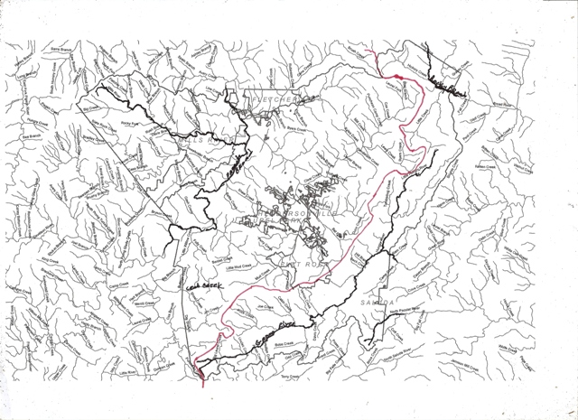
Henderson Heritage
The history and heritage of Henderson County.
